Emissions monitoring and verification support (MVS) capacity
The signatory countries of the Paris Agreement pledged to reduce their greenhouse gas (GHG) emissions. Mitigation of climate change is high on the agenda in Belgium, at the European level and worldwide. Climate action is at the heart of the European Green Deal focusing on cutting greenhouse gas emissions, investing in cutting-edge research and innovations to preserve Europe’s natural environment.
Since it is difficult to judge whether their actions are successful, a transparent system to monitor and report emissions is required.
Emission inventories provide essential information on GHGs and pollutants for policy makers and stakeholders to evaluate progress towards emission abatement measures and to decide on future strategies. However, there are large uncertainties related to the activity data and emission factors used in the development of the inventories.
Satellites are contributing by providing imagery of the atmospheric composition, which enhances the accuracy and timeliness, thereby improving the spatial and temporal resolution of inventories with improved uncertainties.
The BIRA-IASB led project VERBE aims to develop a national MVS capacity in support of government policies and to contribute to the European MVS capacity.
Satellites contributing to the MVS capacity
The Copernicus Sentinel programme has several dedicated satellites being developed for GHG and air quality monitoring with unprecedented accuracy and detail on a global scale. It is critical for the success of a satellite mission to determine its ability to reach the targeted accuracy and precision as per the set mission requirements.
In the framework of the Copernicus CO2M mission, we are developing a science service to support the validation and monitoring of CO2M products.
Science support service for satellite product validation and monitoring
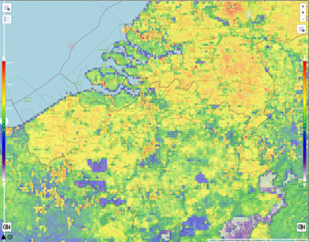
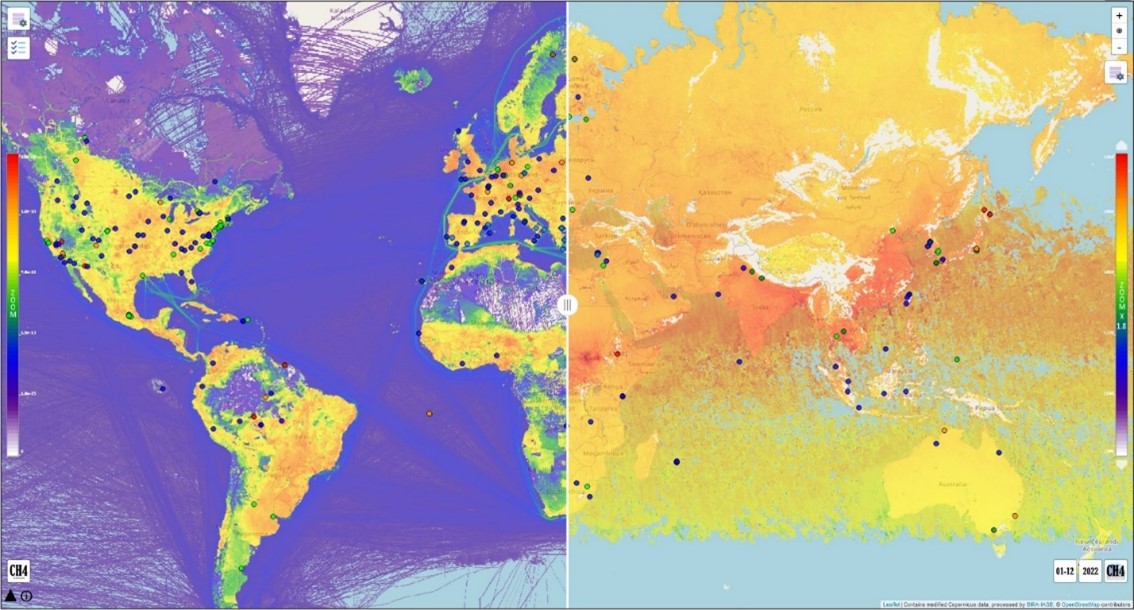
In the framework of a EUMETSAT contract, BIRA-IASB has developed a science support service that provides the users with tools to simultaneously visualise various satellite data alongside emission inventory data (Figure 2) and intercompare (Figure 3).
Additional features include the visualisation of ground-based station characteristics including key instrument parameters, available data products and their quality, network characteristic and overpass statistics. The service will facilitate network design activities to optimise satellite validation and monitoring.